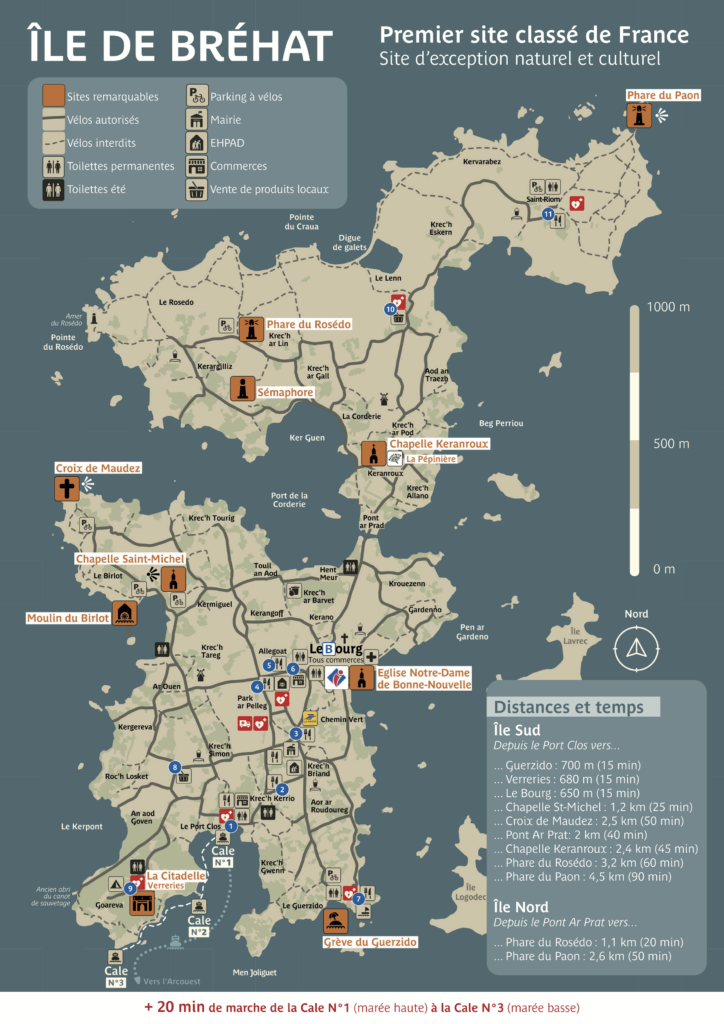
The map of the island of Bréhat, simple and interactive
With our interactive map of Bréhat Island, Easily explore all the must-sees of your stay in Brittany. You will discover the unique landscapes of the archipelago, small sheltered beaches, wild coves, picturesque hamlets and breathtaking viewpoints.
Access via the Pointe de l'Arcouest pier
Unlike other Breton islands, you can't reach Bréhat from Lorient! You embark from the Arcouest Point, near Paimpol, for a ferry crossing of about ten minutes. You will arrive directly at Port-Clos, the island's main port, from where you can reach the Bourg, the true heart of life in Bréhat.
An island on a human scale
There map of Bréhat This accurately reflects reality: the main island isn't very large, and that's precisely what makes it so charming. At 3.5 km long and 1.5 km wide, it's very easy to explore on foot or by bicycle. Following the coastal paths, you'll discover exceptional panoramas and hidden gems.
Explore the archipelago freely
By bike, it takes about two hours to cycle around the main island, but allow more time if you want to explore its paths, flower-filled hamlets, and beaches. On foot, you'll appreciate the beauty of the landscapes and the richness of the vegetation even more.
Planning your stay on the island of Bréhat
Are you now familiar with the map of Bréhat? Discover how come to Bréhat by boat but also the accommodations who can welcome you during your stay in Morbihan. Finally, you can also navigate between the site's menus.